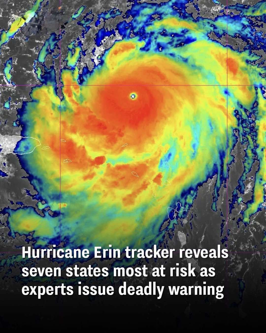
Hurricane Erin tracker reveals seven states most at risk as experts issue deadly warning
With Hurricane Erin heading towards the mainland, millions of Americans across seven states are being urged to prepare for the threat.
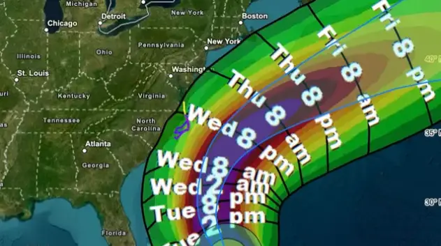
According to meteorologists, Erin could become the fiercest storm of the 2025 Atlantic season yet. Though it is not expected to make landfall, staying some 200 miles out at sea, the impact will be felt in the form of rip currents and massive 20-foot waves.
North Carolina, South Carolina, Georgia, Virginia, New Jersey, New York and Massachusetts are the states facing significant coastal threats.
Hatteras Island, North Carolina, has been evacuated ahead of the approaching hurricane, while officials in the Outer Banks have issued a state of emergency. Heavy rain—two to seven inches—is expected across parts of Georgia and the Carolinas, where flood warnings are already in place. The National Hurricane Center says tropical storm-force winds and coastal flooding could begin in the Outer Banks by late Wednesday, with dangerous gusts reaching the Mid-Atlantic and southern New England by Friday.
Officials advise beachgoers and residents to follow safety instructions from lifeguards and local authorities.
“There are mixed signals on Erin’s future intensity,” the NHC said according to The Daily Mail. “More favorable environmental shear and upper-level divergence in 24–36 hours could allow some re-intensification, but Erin’s slow motion and large size may bring cooler water to the surface, limiting significant strengthening.”
The storm is expected to reach the Tri-State Area by Thursday, with the Jersey Shore and Long Island’s South Shore most at risk. Hyde County has also issued an emergency order for Ocracoke Island, with Donnie Shumate, Hyde County Public Information Officer, stating, “While Hurricane Erin is expected to stay well off our coast, the system will continue to increase in size and is forecast to bring life-threatening impacts to the Ocracoke coastline and render Highway 12 impassable.”
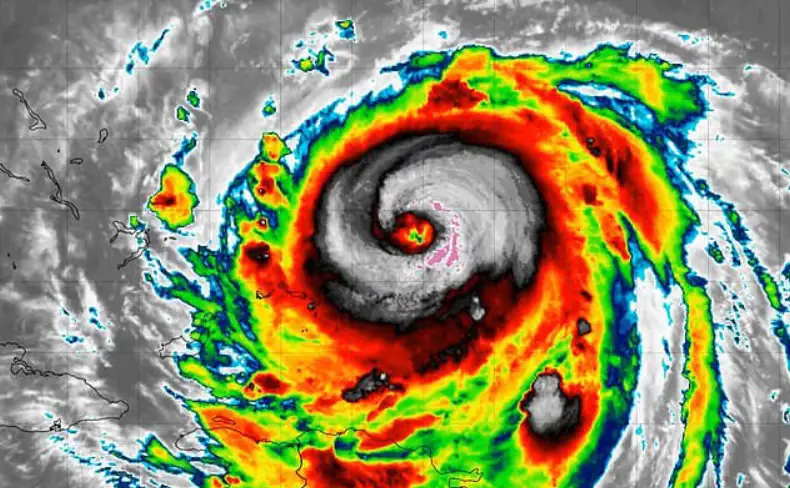
According to the NHC, the storm may have weakened, but that doesn’t mean it won’t remain “dangerous” throughout the middle of the week. “Even though some weakening is forecast beginning Monday night, Erin will remain a large and dangerous major hurricane through the middle of the week,” they added.
Also, the Bahamas has issued a Tropical Storm Watch for its central islands, while warnings remain for the Turks and Caicos and the southeast Bahamas. In North Carolina, Dare County evacuated most of its 38,000 residents, with officials urging people to leave immediately for their own safety.
Please SHARE this article with your family and friends on Facebook.
Bored Daddy
Love and Peace